Filter by category
Or search
Loading search form...
Explanation
SamSamWater makes information on water and sanitation easy to find and accessible for all. This page contains a database with practical information, data and (GIS)maps.
We believe information should be shared to make water and sanitation projects more successful. The information in the database is gathered from numerous sources, such as research institutes, companies, NGOs and government organisations.
Do you have information we can integrate into this database, or if you have comments or questions, please contact us!
133 items found within the database
Simon Maddrell and Ian Neal, Excellent Development (2012)
Erik Nissen-Petersen, ASAL Consultants Ltd. (2011)
Erik Nissen-Petersen, ASAL Consultants Ltd. (2011)
E.H. Hofkes and J.T. Visscher, International Reference Centre for Community Water Supply and Sanitation The Hague, The Netherlands (1986)
A.W.A. Oosterbaan & J.V. Martinez, Departemento de Ague para el Chaco (1987)
RAIN Foundation, RAIN Foundation ()
Cedrick Gijsbertsen, VU (2007)
Merel Hoogmoed, VU (2007)
G.P. Kruseman, N.A. de Ridder, ILRI (1994)
IDsW, IDsW, NHV (2010)
Tony Appelo, IAH (2006)
Ralph C. Heath, USGS (1987)
Neil Herath, Comminity Water Supply & Sanitation Project (CWSSP), Ministry of Housing, Construction & Public Utilities, Sri Lanka (1995)
J.W. van Hoorn, Wageningen University ()
M.G. Bos, ILRI (1989)
H.P. Ritzema, ILRI (1994)
Isaya V. Sijali, Sida's Regional Land Management Unit (2001)
Aichi Kitalyi, Alphonce Musili, Jorge Suazo, Fredrick Ogutu, Sida's Regional Land Management Unit (2002)
Bureau of Reclamation, U.S. Department of the Interior (1998)
Brian Mathew, IRC (2005)
Kithinji Mutunga, Will Critchley, Sida's Regional Land Management Unit (2001)
U.S. Army Corps of Engineers, U.S. Army Corps of Engineers (1999)
WHO, WHO (2006)
HR Wallingford, DFID, HR Wallingford (2003)
Lucas Borst, Sander de Haas, VU (2006)
ICS, IUGS, ICS (2008)
Richard Holden, Tania Swanepoel, DWAF (2004)
NWP, NWP (2006)
Kithinji Mutunga, Will Critchley, Sida's Regional Land Management Unit (2002)
ERHA, RAIN Foundation, ()
RAIN Foundation, RAIN Foundation (2008)
Janette Worm, Tim van Hattum, Agromisa (2006)
Nuhu Hatibu, Henry F. Mahoo, Sida's Regional Land Management Unit (2000)
Th.M. Boers, ILRI (1994)
T.H. Thomas, D.B. Martinson, IRC (2007)
Jo Smet, Christine van Wijk, IRC (2002)
Jo Smet, Christine van Wijk, IRC (2002)
Jo Smet, Christine van Wijk, IRC (2002)
Jo Smet, Christine van Wijk, IRC (2002)
Jo Smet, Christine van Wijk, IRC (2002)
Jo Smet, Christine van Wijk, IRC (2002)
Jo Smet, Christine van Wijk, IRC (2002)
Jo Smet, Christine van Wijk, IRC (2002)
Jo Smet, Christine van Wijk, IRC (2002)
Jo Smet, Christine van Wijk, IRC (2002)
Jo Smet, Christine van Wijk, IRC (2002)
Jo Smet, Christine van Wijk, IRC (2002)
Jo Smet, Christine van Wijk, IRC (2002)
Jo Smet, Christine van Wijk, IRC (2002)
Jo Smet, Christine van Wijk, IRC (2002)
Jo Smet, Christine van Wijk, IRC (2002)
Jo Smet, Christine van Wijk, IRC (2002)
Jo Smet, Christine van Wijk, IRC (2002)
Jo Smet, Christine van Wijk, IRC (2002)
Jo Smet, Christine van Wijk, IRC (2002)
Jo Smet, Christine van Wijk, IRC (2002)
Jo Smet, Christine van Wijk, IRC (2002)
Jo Smet, Christine van Wijk, IRC (2002)
Jo Smet, Christine van Wijk, IRC (2002)
NWP, NWP (2010)
NWP, NWP (2009)
NWP, NWP (2006)
NWP, NWP (2007)
NWP, NWP (2006)
NWP, NWP (2006)
NWP, NWP (2006)
Ian Gale, UNESCO International Hydrological Programme, IAH (2005)
VSF-Belgium, VSF-Belgium (2006)
WaterAid, WaterAid (2007)
W.F.J. van Beers, ILRI (1983)
Jasper Jansen, VU (2007)
Will Critchley, Dan Miiro, Jim Ellis-Jones, Stephen Briggs, Joy Tumuhairwe, Sida's Regional Land Management Unit (1999)
Anthony Nyakuni, Sida's Regional Land Management Unit (2001)
Marloes L. Mul, CRC Press/Balkema (2009)
Erik Nissen-Petersen, Birgit Madsen, Munguti Katui-Katua, DANIDA (2006)
Erik Nissen-Petersen, DANIDA (2006)
Erik Nissen-Petersen, DANIDA (2006)
Erik Nissen-Petersen, DANIDA (2006)
Erik Nissen-Petersen, DANIDA (2006)
Erik Nissen-Petersen, Sida's Regional Land Management Unit (2000)
Erik Nissen-Petersen, WEDC Conference (1997)
Erik Nissen-Petersen, DANIDA (2006)
Will Critchley, Klaus Siegert, FAO (1991)
A.J. Clemmens, T.L. Wahl, M.G. Bos, J.A. Replogle, ILRI (2001)
Erik Nissen-Petersen, DANIDA (2006)
Erik Nissen-Petersen, DANIDA (2006)
WHO, WHO ()
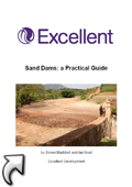
Sand Dams: a Practical Guide
Simon Maddrell and Ian Neal, Excellent Development (2012)
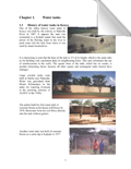
This manual describes the process of siting, design, construction and management of sand dams. It is aimed at technical and programme management staff working in arid and semi-arid lands who are interested in trialling the application of sand dams in new areas. The manual draws upon the experience of constructing sand dams in Kenya, where the majority of the world’s sand dams are located. Its primary purpose is to capture this experience. (source)
SSWM Toolbox
The Sustainable Sanitation and Water Management Toolbox is an open-source capacity development tool for the local level, linking water management, sanitation and agriculture.
Focussing on the human influence on the water and nutrient cycle, it presents solutions for a sustainable use, treatment and reuse of water resources.
The Toolbox aims at capacitating people not only with knowledge, but also with application skills. It provides both help in project planning and implementation, focuses on technologies (hardware) and behavioural change approaches (software), and compiles the relevant further readings, links, exercises etc. for each topic. In that way, it is not a reinvention of the wheel, but the long needed overview on the host of approaches and technologies in the water and sanitation sector. The Toolbox contains also a large library, a glossary, a Train-the-Trainer's section topped by downloadable and adjustable PowerPoint presentations on specific topics. It is open source and for free – but quality approved. Today, the Toolbox is used as online resource for both, learning and teaching. This concept is coupled with training courses and workshops based on a worldwide network.
Sand dams or silt traps?
Erik Nissen-Petersen, ASAL Consultants Ltd. (2011)
It has been known from the African Land Development Project (ALDEV) since the late 1950s, that the spillways of sand dams must be raised in stages not exceeding a height of 50 cm in order
for floods to deposit coarse sand from where most water can be extracted. If a spillway is not built in stages, then silt will be deposited instead of sand and very little water, if any, can be
extracted from such a sand dam - or is it a silt trap? (source)
Serie:
Water for Arid Lands (all items in this serie)
Categories:
Technology and techniques
Groundwater hydrology
Water for Arid Lands (all items in this serie)
Categories:
Technology and techniques
Groundwater hydrology
Subsurface dams built of soil
Erik Nissen-Petersen, ASAL Consultants Ltd. (2011)
Paper on subsurface dams, their benefits and practical experiences with the planning, design and construction of subsurface dams. (source)
Serie:
Water for Arid Lands (all items in this serie)
Categories:
Technology and techniques
Rainwater harvesting
Groundwater hydrology
Water for Arid Lands (all items in this serie)
Categories:
Technology and techniques
Rainwater harvesting
Groundwater hydrology
Artificial groundwater recharge for water supply of medium-size communities in developing countries
E.H. Hofkes and J.T. Visscher, International Reference Centre for Community Water Supply and Sanitation The Hague, The Netherlands (1986)
This document integrates material selected from many sources, both published and unpublished. The focus is on potential application of artificial groundwater recharge for water supply of medium-size communities.
The purpose of this document is to provide planners and engineers with practical information to assess the potential for application of artificial groundwater recharge schemes in rural water supply programmes or projects. (source)
The purpose of this document is to provide planners and engineers with practical information to assess the potential for application of artificial groundwater recharge schemes in rural water supply programmes or projects. (source)
Cisternas rurales
A.W.A. Oosterbaan & J.V. Martinez, Departemento de Ague para el Chaco (1987)
Un manual para su dimensionamiento construction, y mantenimiento en el chaco central, Paraguay. (source)
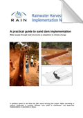
A practical guide to sand dam implementation
RAIN Foundation, RAIN Foundation ()
Water supply through local structures as adaptation to climage change (source)
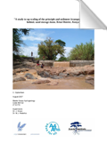
A study to upscaling of the principle and sediment transport processes behind sand storage dams, Kitui District, Kenya
Cedrick Gijsbertsen, VU (2007)
A study on the upscaling of the sand storage dam and the sedimentation processes that occur in the surroudings of the sand storage dam. (source)
Serie:
Sanddam.org Sand storage dams reports (all items in this serie)
Categories:
Rainwater harvesting
Infiltration and artificial recharge
Groundwater hydrology
Sanddam.org Sand storage dams reports (all items in this serie)
Categories:
Rainwater harvesting
Infiltration and artificial recharge
Groundwater hydrology
AfricaMap
Brilliant collection of maps. Contains an extensive resource of topographical maps, from 1:1,000,000 reference maps to 1:2,500 city maps. To view the maps, click on the tab 'Map Layers', click on 'Base mapping' and select the desired maps.
Akvopedia from Akvo.org
Wikipedia-like knowledgebase on water and sanitation. Contains many useful smart and affordable technical solutions and effective approaches.
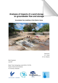
Analyses of impacts of a sand storage dam on gw flow and storage
Merel Hoogmoed, VU (2007)
(source)
Serie:
Sanddam.org Sand storage dams reports (all items in this serie)
Categories:
Rainwater harvesting
Infiltration and artificial recharge
Groundwater hydrology
Sanddam.org Sand storage dams reports (all items in this serie)
Categories:
Rainwater harvesting
Infiltration and artificial recharge
Groundwater hydrology
Analysis and Evaluation of Pumping Test Data
G.P. Kruseman, N.A. de Ridder, ILRI (1994)
A reference book on aquifer test analyses methods. The first chapter summarizes the basic concepts and definitions of terms relevant to the subject. The next chapter describes how to conduct a pumping test. The remaining chapters deal with the analysis and evaluation of pumping test data from a variety of aquifer types or aquifer systems, and from tests conducted under particular technical conditions. (source)
Serie:
ILRI Publication 47 (all items in this serie)
Categories:
Technology and techniques
Groundwater hydrology
ILRI Publication 47 (all items in this serie)
Categories:
Technology and techniques
Groundwater hydrology
Appropedia
Wikipedia-like knowledgebase on collaborative solutions in sustainability, poverty reduction and international development. Including sections on Water and Health.
Aquo-lex Waterwoordenboek
IDsW, IDsW, NHV (2010)
A list with water-related expresions and it's explenation (in dutch) (source)
ArcGIS Services Directory
Directory of the ESRI basemaps, with links to open them in ESRI software (e.g. ArcMAP) or in Google Earth (not available for every map).
Arsenic in groundwater – a world problem
Tony Appelo, IAH (2006)
Symposium organised by IAH’s Dutch Chapter and the Netherlands’ Hydrological Society, 29 November 2006, Utrecht, The Netherlands
Arsenic contamination of groundwater has occurred in various parts of the world, most notably the Ganges Delta of Bangladesh and West Bengal, India, causing serious arsenic poisoning amongst large numbers of people. It is a natural occurring high concentration of arsenic in deeper levels of groundwater, which became a high-profile problem in recent years due to the use of deep tube wells for water supply in the Ganges Delta. Parts of Thailand, Taiwan, Argentina, Chile and China have also been affected. (source)
ASTER GDEM
Web interface to select and download ASTER Global Digital Elevation Model (GDEM) files. The ASTER GDEM has a resolution of 15 x 15 meter and is the most detailed elevation model that is freely available worldwide.
Basic Ground-Water Hydrology
Ralph C. Heath, USGS (1987)
A document with the basics on (groundwater) hydrology in well understandable language (source)
Construction of wire-reinforced cement mortar tanks
Neil Herath, Comminity Water Supply & Sanitation Project (CWSSP), Ministry of Housing, Construction & Public Utilities, Sri Lanka (1995)
this document has been scanned from earlier manuals and standardizations prepared by Neil Herath for CWSSP – Sri Lanka ( April 1995), and as Manual 3 of the Technical Manual Series on Rural Water Supply and Sanitation, Gravity Water Supply Systems: design and construction (January 2005). It is redesigned to look like the 2005 CWSSP manual guiding field work on wirereinforced cement mortar tanks, commonly known as ferrocement tanks (Han Heijnen, October 2010) (source)
CoordTrans geographic coordinates conversion
CoordTrans converts geographic coordinates between different coordinate systems. Convert between UTM, WGS84 and NAD27 / NAD83, and more. You can convert single coordinates, or coordinates stored in text files, Access databases or in ESRI Shapefiles. A free 7 day trial version can be downloaded. After you can buy the software for € 19.95 (standard) or € 49 (pro version).
Determining hydraulic conductivity with the inversed auger hole and infiltrometer methods
J.W. van Hoorn, Wageningen University ()
(source)
Digital atlas of Namibia
Contains maps on climate, physical geography, living-resources, land & history and people, services & infrastructure.
Discharge measurement structures
M.G. Bos, ILRI (1989)
A handbook that presents instructions, standards, and procedures for the selection, design, and use of structures, which measure or regulate the flow rate in open channels. (source)
Serie:
ILRI Publication 20 (all items in this serie)
Categories:
Technology and techniques
Surface water hydrology
ILRI Publication 20 (all items in this serie)
Categories:
Technology and techniques
Surface water hydrology
DIVA GIS
Download free GIS data (boundaries, places, roads, elevation, land cover, population) for any country in the world.
Drainage Principles and Applications
H.P. Ritzema, ILRI (1994)
A handbook with discussions and aspects on drainage systems (source)
Serie:
ILRI Publication 16 (all items in this serie)
Categories:
Technology and techniques
Groundwater hydrology
ILRI Publication 16 (all items in this serie)
Categories:
Technology and techniques
Groundwater hydrology
Drip Irrigation; Options for smallholder farmers in eastern and southern Africa
Isaya V. Sijali, Sida's Regional Land Management Unit (2001)
Smallholder farmers in the semi-arid regions of eastern and southern Africa have to depend on erratic, unreliable and low rainfall for their livelihoods. Subsistence staple food crops are generally grown under rainfed conditions. Consequently there is a growing interest in complementing this risky rainfed food production with cultivation of high-value vegetable crops and fruits. But in most cases this means these small-scale vegetable gardens and orchards must be irrigated in order to assure an economic return. Drip irrigation methods minimize the non-productive water losses associated with conventional irrigation, e.g. from evaporation and soil runoff, and thus can make more efficient use of the already minimal water supplies in these arid areas. But until recently drip irrigation technology had been associated with costly investments available only to large commercial farmers. Now there is growing interest in the technique and many efforts are being made around the world to develop low-cost, simple, drip irrigation systems suitable for smallholder farmers. This handbook presents some of these drip irrigation options that can be promoted by extension officers in eastern and southern Africa. It describes the most interesting small-scale low-cost drip irrigation methods of which the author and the other contributors have practical experience. It also gives a brief overview of methods that have been used successfully in other parts of the world with details of how to obtain further information about them or order equipment. (source)
Serie:
RELMA Technical Handbook Series No. 24 (all items in this serie)
Categories:
Irrigation, agriculture and land husbandry
RELMA Technical Handbook Series No. 24 (all items in this serie)
Categories:
Irrigation, agriculture and land husbandry
East View Cartographic
Online shop selling a wide range of maps including topographic maps of many (developing) countries. Some maps are available in print, others only as digital files. Has a wider collection than Omnimap, but is more expensive.
Enclosures to protect and conserve; For better livelihood of the West Pokot community
Aichi Kitalyi, Alphonce Musili, Jorge Suazo, Fredrick Ogutu, Sida's Regional Land Management Unit (2002)
A fieldguide to improve land resources. A guide with tips and tricks on land rehabilitation. (source)
Serie:
RELMA Technical Pamphlet No. 2 (all items in this serie)
Categories:
Irrigation, agriculture and land husbandry
RELMA Technical Pamphlet No. 2 (all items in this serie)
Categories:
Irrigation, agriculture and land husbandry
Engineering Geology Field Manual
Bureau of Reclamation, U.S. Department of the Interior (1998)
The manual etablishes common guidelines, procedures and concepts for the collection, evaluation and presentation of geologic information. How to use geological information to obtain site charateristics and risk evaluation. (source)
Ensuring Sustained Beneficial Outcomes for Water and Sanitation Programmes in the Developing World
Brian Mathew, IRC (2005)
A thesis that gives approaches to achieve sustained beneficial outcomes from WATSAN (WAter and SAnitation projects in development countries). Secondly it gives insight in the up-scaling of these approaches, (source)
Serie:
Occasional Paper Series 40 (all items in this serie)
Categories:
Socio-economic and organisation
Sanitation
Occasional Paper Series 40 (all items in this serie)
Categories:
Socio-economic and organisation
Sanitation
European Digital Archive of Soil Maps of Africa
An impressive collection of soil maps from all over Africa (over 2000!). All maps can be viewed and downloaded in high resolution. Contains also some topographical maps. Searchable by country, scale, year, of keyword.
European Digital Archive of Soil Maps of Asia
A large collection of soil maps of Asia. Searchable by country, scale, year, of keyword.
European Digital Archive of Soil Maps of the World
Soil maps of the world, a large collection of scanned soil maps from all over the world.
Farmers' initiatives in land husbandry; Promising technologies for the drier areas of East Africa
Kithinji Mutunga, Will Critchley, Sida's Regional Land Management Unit (2001)
Farmers’ Initiatives in Land Husbandry’ lays out case studies of 18 of the most interesting technical systems uncovered during three years of working with farmer innovators in East Africa. (source)
Serie:
RELMA Technical Handbook Series No. 27 (all items in this serie)
Categories:
Irrigation, agriculture and land husbandry
Socio-economic and organisation
RELMA Technical Handbook Series No. 27 (all items in this serie)
Categories:
Irrigation, agriculture and land husbandry
Socio-economic and organisation
Free Geography Tools - E00 conversion
Converting E00 Vector Data To Shapefiles. The method uses the program 'import71.exe'. If you have ArcView 9 this program can be found in the ArcGIS/bin/ folder where the ArcGIS program is installed.
GeoCommunity GIS Data Depot
Free GIS data on most countries of the world (boundaries, roads, places, rivers, etc.).
Geonames.org
Search for names of cities, town, villages, regions, districts, mountains, nature reserves, etc. in a worldwide geographical database. Contains (much) more names than Google Maps.
Global Land Cover Facility
An interface to search and download (free) satellite imagery from around the world. Imagery from (a.o.) Landsat, ASTER, IKONOS, MODIS and SRTM satellites can be accessed. Detailes on the different types of data can be found here: http://glcf.umiacs.umd.edu/data/.
Google Map Maker Data Download
Download the GIS data (in .SHP or .KML format) that is behind Google Maps. Contains information on (rail)roads, places, waterbodies, nature reserves, etc. The data is provided free for non-commercial use.
Groundwater Hydrology
U.S. Army Corps of Engineers, U.S. Army Corps of Engineers (1999)
An overview and detailed description on the different steps to be taken to enhance a groundwater-related project (source)
Guidelines for drinking-water quality
WHO, WHO (2006)
The document describes a “Framework for Drinking-water Safety” and discusses the roles and responsibilities of different stakeholders, including the complementary roles of national regulators, suppliers, communities and independent “surveillance” agencies.
Handbook for the Assessment of Catchment Water Demand and Use
HR Wallingford, DFID, HR Wallingford (2003)
The book provides the user with a range of appropriate methods for estimating water demand and use across a range of water uses including environmental, urban, industrial, rural domestic and agricultural sectors. (source)
Hydrology of Sand Storage Dams - A case study in the Kiindu catchment, Kitui District, Kenya
Lucas Borst, Sander de Haas, VU (2006)
This report reflects the results of a research project concerning the hydrology around sand storage dams. The Kitui district is one of the arid and semi-arid lands of Kenya. For (drinking)water most people heavily rely on water supply from the riverbeds of ephemeral rivers. SASOL is a local NGO which builds so called sand storage dams in ephemeral rivers to increase the water availability during the dry season. Sand storage dams are small (generally a few meters high) dams built in the riverbed behind which sand accumulates, enlarging the natural aquifer. The groundwater in the riverbed is obstructed by the dam and retained between the pores in the sand, making it available for people and animals during the dry season. (source)
Serie:
Sanddam.org Sand storage dams reports (all items in this serie)
Categories:
Rainwater harvesting
Infiltration and artificial recharge
Groundwater hydrology
Sanddam.org Sand storage dams reports (all items in this serie)
Categories:
Rainwater harvesting
Infiltration and artificial recharge
Groundwater hydrology
IGRAC Global Groundwater Information System
Global Groundwater Information System, with maps on groundwater quality, quantity, development, artificial recharge and more. But it only shows averages per country. Only works in Internet Explorer.
ILRI GIS data
Search and download (free) GIS data from the ILRI (International Livestock Research Institute). Contains much GIS data on Kenya (from boundaries to population data) and some data on other countries.
International Stratigraphic Chart
ICS, IUGS, ICS (2008)
The classic 'geological time scale' is a hierarchical ordinal system, in which the eras are ranked: 'stages' nest within 'series'within 'systems' within 'eras' within 'eons'. The ICS publishes a representation of the geologic timescale as a coloured stratigraphic chart, showing the order and names of the elements of the time scale, and the dates of the boundaries as fixed through GSSP where available. (source)
Introductory Guide to Appropriate Solutions for Water and Sanitation
Richard Holden, Tania Swanepoel, DWAF (2004)
This guideline is for use by municipalities and their service providers as an introduction to the range of appropriate solutions available for water supply and sanitation, and where and how these are suited to different situations. (source)
ISRIC - World Soil Information Database
ISRIC - World Soil Information Database, you can search the database using the menu on the left. Some of the reports and maps can be viewed online and downloaded.
l'Eau: des Solutions Simples et Économiques
NWP, NWP (2006)
Cette brochure sur l’eau, comme sa contrepartie ‘Des Solutions intelligentes pour l’assainissement’ (Smart Sanitation Solutions), relate des exemples d’innovations à petite échelle telles que la désinfection solaire de l’eau, l’emploi de filtres à eau efficaces et peu coûteux, le recours à l’irrigation goutte à goutte à bas-coût et l’utilisation de pompes manuelles fabriquées localement et cinq fois moins chères que les pompes importées. En adoptant ces technologies, les foyers défavorisés dans les zones rurales peuvent doubler, voire tripler leur revenu annuel.
Les solutions à petite échelle ont montré qu’elles pouvaient être économiquement rentables. Installées en grand nombre, elles peuvent à la fois améliorer la santé publique, relancer la production agricole et générer des activités locales. C’est pourquoi la diffusion à grande échelle de ces technologies est essentielle. (source)
Serie:
Smart water solutions (all items in this serie)
Categories:
Technology and techniques
Water quality, treatment and purification
Smart water solutions (all items in this serie)
Categories:
Technology and techniques
Water quality, treatment and purification
LMNO Engineering fluid flow calculations
Many calculations and conversions on: flow in pipes, open channels, hydrology, groundwater, weirs, water hammer, pressure, discharge, etc.
Low-cost methods of rainwater storage; Results from field trials in Ethiopia and Kenya
Kithinji Mutunga, Will Critchley, Sida's Regional Land Management Unit (2002)
Rainwater harvesting is one solution to the problems of water shortage in the drier areas of Africa, but its implementation presents a number of challenges, of which storage is the main one. Many people in rural areas who would like to harvest rainwater lack the resources to do so. Conventional stone, brick or ferrocement tanks are costly, and therefore there is a great need for cheaper alternatives. This publication gives an account of two trials conducted in 1998/99 to investigate some such alternatives. In Ethiopia, five different methods of tank construction were tested in the suburbs of Nazareth town in Adama Woreda. In Kenya, six different methods were tested during the same period at various locations in Machakos and Makueni Districts. A main feature of the alternative tank designs is that they are built underground, which reduces the need for reinforcement materials. (source)
Serie:
RELMA Technical Handbook Series No. 28 (all items in this serie)
Categories:
Technology and techniques
Rainwater harvesting
Roofwater harvesting
RELMA Technical Handbook Series No. 28 (all items in this serie)
Categories:
Technology and techniques
Rainwater harvesting
Roofwater harvesting
Manual on Sand Dams in Ethiopia
ERHA, RAIN Foundation, ()
A practical approach on sand dam site selection, design and construction. A tool for combining sand dams with other rainwater harvesting structures. (source)
Map Library
The Map Library is a source of public domain basic map data concerning administrative boundaries in developing countries. Contains data from Africa and Central America.
NASA SRTM elevation data
Information and backgrounds on the SRTM (Shuttle Radar Topography Mission) elevation data (DEM). The data can also be downloaded from this site, however the interface at GLCF is much more easy to navigate.
OneGeology Portal
A beautiful web-viewer with a lot of digital geological maps all over the World. Some maps have a very large scale (continent), others are more detailed (country). You can export the maps from their portal as KML files to view in Google Earth. Background information and a 'Getting started' guide can be found here: http://www.onegeology.org/portal/home.html.
Onimap
Online shop selling a wide range of maps including topographic maps of many (developing) countries. Some maps are available in print, others only as digital files. Has a (bit) smaller collection than Eastview, but is (much) cheaper.
Poehali Russion Topo Maps
Very detailed topographic maps made in Soviet time, but are still very useful for reference, although the Russian labels are hard to read. In the bottom left of the screen you can switch the interface to English.
RAIN Water Quality Guidelines; Guidelines and practical tools on rainwater quality
RAIN Foundation, RAIN Foundation (2008)
This document addresses RAINs guidelines towards water quality and gives criteria and practical guidelines to improve and maintain an acceptable water quality of harvested rainwater for drinking purpose. (source)
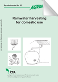
Rainwater harvesting for domestic use
Janette Worm, Tim van Hattum, Agromisa (2006)
Book Agrodok 43: 'Rainwater harvesting for domestic use' with useful and practical applications of rainwater harvesting in developing countries. (source)
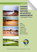
Rainwater harvesting for natural resources management; A planning guide for Tanzania
Nuhu Hatibu, Henry F. Mahoo, Sida's Regional Land Management Unit (2000)
A planning handbook that provides planners with practical tips on how rainwater harvesting can form an integrated part of district development efforts. The book also gives practical guidelines in the planning steps required to incorporate rainwater harvesting in development plans, and shows how to implement them in the farmers’ context. (source)
Serie:
RELMA Technical Handbook Series No. 22 (all items in this serie)
Categories:
Technology and techniques
Rainwater harvesting
Roofwater harvesting
Infiltration and artificial recharge
RELMA Technical Handbook Series No. 22 (all items in this serie)
Categories:
Technology and techniques
Rainwater harvesting
Roofwater harvesting
Infiltration and artificial recharge
Rainwater Harvesting in Arid and Semi-Arid Zones
Th.M. Boers, ILRI (1994)
The publication describes a procedure for the design of micro-catchments in sem-arid areas. (source)
Serie:
ILRI Publication 55 (all items in this serie)
Categories:
Rainwater harvesting
Roofwater harvesting
ILRI Publication 55 (all items in this serie)
Categories:
Rainwater harvesting
Roofwater harvesting
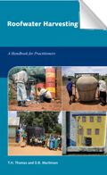
Roofwater Harvesting; A Handbook for Practitioners
T.H. Thomas, D.B. Martinson, IRC (2007)
A handbook with guidelines for implementing (low cost) domestic roofwater harvesting systems or programmes. (source)
Serie:
Technical Paper Series 49 (all items in this serie)
Categories:
Technology and techniques
Rainwater harvesting
Roofwater harvesting
Technical Paper Series 49 (all items in this serie)
Categories:
Technology and techniques
Rainwater harvesting
Roofwater harvesting
SamSamWater Climate Tool (precipitation & evaporation)
Local climate data is very important for water studies. However, climate data is not always available or accessible. The SamSamWater Climate Tool uses data from 28800 stations of FAOCLIM to estimate precipitation and evaporation anywhere on Earth.
SamSamWater UTM Zones Tool
The Universal Transverse Mercator (UTM) coordinate system is a method of specifying locations on Earth. When working with a GPS or maps based on the UTM-system, it is necessary to know in which UTM zone you are. This tool displays all UTM grid zones on a map, which enables you to find the correct zone.
SandDam.org
All you need to know about sand storage dams.
Search Alterra maps
A collection of maps from the Alterra Institute (Wageningen University). Use the searchform on the right, the 'Region thesaurus' on the left doesn't work properly.
Small Community Water Supplies: Aeration (chapter 13)
Jo Smet, Christine van Wijk, IRC (2002)
(source)
Serie:
Small Community Water Supplies: Technology, people and partnership (all items in this serie)
Categories:
Technology and techniques
Water quality, treatment and purification
Small Community Water Supplies: Technology, people and partnership (all items in this serie)
Categories:
Technology and techniques
Water quality, treatment and purification
Small Community Water Supplies: Artificial recharge (chapter 6)
Jo Smet, Christine van Wijk, IRC (2002)
(source)
Serie:
Small Community Water Supplies: Technology, people and partnership (all items in this serie)
Categories:
Technology and techniques
Infiltration and artificial recharge
Small Community Water Supplies: Technology, people and partnership (all items in this serie)
Categories:
Technology and techniques
Infiltration and artificial recharge
Small Community Water Supplies: Coagulation and flocculation (chapter 14)
Jo Smet, Christine van Wijk, IRC (2002)
(source)
Serie:
Small Community Water Supplies: Technology, people and partnership (all items in this serie)
Categories:
Technology and techniques
Water quality, treatment and purification
Small Community Water Supplies: Technology, people and partnership (all items in this serie)
Categories:
Technology and techniques
Water quality, treatment and purification
Small Community Water Supplies: Desanilation Technology (chapter 18)
Jo Smet, Christine van Wijk, IRC (2002)
(source)
Serie:
Small Community Water Supplies: Technology, people and partnership (all items in this serie)
Categories:
Technology and techniques
Water quality, treatment and purification
Small Community Water Supplies: Technology, people and partnership (all items in this serie)
Categories:
Technology and techniques
Water quality, treatment and purification
Small Community Water Supplies: Disinfection (chapter 19)
Jo Smet, Christine van Wijk, IRC (2002)
(source)
Serie:
Small Community Water Supplies: Technology, people and partnership (all items in this serie)
Categories:
Technology and techniques
Water quality, treatment and purification
Small Community Water Supplies: Technology, people and partnership (all items in this serie)
Categories:
Technology and techniques
Water quality, treatment and purification
Small Community Water Supplies: Groundwater Withdrawal (chapter 10)
Jo Smet, Christine van Wijk, IRC (2002)
(source)
Serie:
Small Community Water Supplies: Technology, people and partnership (all items in this serie)
Categories:
Technology and techniques
Groundwater hydrology
Small Community Water Supplies: Technology, people and partnership (all items in this serie)
Categories:
Technology and techniques
Groundwater hydrology
Small Community Water Supplies: Integrated water resource management (chapter 5)
Jo Smet, Christine van Wijk, IRC (2002)
(source)
Serie:
Small Community Water Supplies: Technology, people and partnership (all items in this serie)
Categories:
Socio-economic and organisation
Small Community Water Supplies: Technology, people and partnership (all items in this serie)
Categories:
Socio-economic and organisation
Small Community Water Supplies: Introduction (chapter 1)
Jo Smet, Christine van Wijk, IRC (2002)
This book provides a general introduction to a wide range of technologies. Among the topics covered are: planning and management of small water supplies, community water supplies in Central and Eastern European countries, water quality and quantity, integrated water resources management, artificial recharge, rainwater harvesting, spring water tapping, groundwater withdrawal, water lifting, surface water intake, water treatment, aeration, coagulation and flocculation, sedimentation, multi-stage filtration, desalination technology, disinfection, household level water treatment, technologies for arsenic and iron removal from ground water, and emergency and disaster water supply.
Target audience: Engineers and other staff involved in water supply programmes and projects, and students (source)
Serie:
Small Community Water Supplies: Technology, people and partnership (all items in this serie)
Categories:
Technology and techniques
Socio-economic and organisation
Small Community Water Supplies: Technology, people and partnership (all items in this serie)
Categories:
Technology and techniques
Socio-economic and organisation
Small Community Water Supplies: Multi-stage filtration (chapter 16)
Jo Smet, Christine van Wijk, IRC (2002)
(source)
Serie:
Small Community Water Supplies: Technology, people and partnership (all items in this serie)
Categories:
Technology and techniques
Water quality, treatment and purification
Small Community Water Supplies: Technology, people and partnership (all items in this serie)
Categories:
Technology and techniques
Water quality, treatment and purification
Small Community Water Supplies: Planning and Management (chapter 2)
Jo Smet, Christine van Wijk, IRC (2002)
(source)
Serie:
Small Community Water Supplies: Technology, people and partnership (all items in this serie)
Categories:
Socio-economic and organisation
Small Community Water Supplies: Technology, people and partnership (all items in this serie)
Categories:
Socio-economic and organisation
Small Community Water Supplies: Pumping (chapter 9)
Jo Smet, Christine van Wijk, IRC (2002)
(source)
Serie:
Small Community Water Supplies: Technology, people and partnership (all items in this serie)
Categories:
Technology and techniques
Groundwater hydrology
Small Community Water Supplies: Technology, people and partnership (all items in this serie)
Categories:
Technology and techniques
Groundwater hydrology
Small Community Water Supplies: Rain water harvesting (chapter 7)
Jo Smet, Christine van Wijk, IRC (2002)
(source)
Serie:
Small Community Water Supplies: Technology, people and partnership (all items in this serie)
Categories:
Technology and techniques
Rainwater harvesting
Small Community Water Supplies: Technology, people and partnership (all items in this serie)
Categories:
Technology and techniques
Rainwater harvesting
Small Community Water Supplies: Rapid filtration (chapter 17)
Jo Smet, Christine van Wijk, IRC (2002)
(source)
Serie:
Small Community Water Supplies: Technology, people and partnership (all items in this serie)
Categories:
Technology and techniques
Water quality, treatment and purification
Small Community Water Supplies: Technology, people and partnership (all items in this serie)
Categories:
Technology and techniques
Water quality, treatment and purification
Small Community Water Supplies: Sedimentation (chapter 15)
Jo Smet, Christine van Wijk, IRC (2002)
(source)
Serie:
Small Community Water Supplies: Technology, people and partnership (all items in this serie)
Categories:
Technology and techniques
Water quality, treatment and purification
Small Community Water Supplies: Technology, people and partnership (all items in this serie)
Categories:
Technology and techniques
Water quality, treatment and purification
Small Community Water Supplies: Small community water services (chapter 3)
Jo Smet, Christine van Wijk, IRC (2002)
(source)
Serie:
Small Community Water Supplies: Technology, people and partnership (all items in this serie)
Categories:
Socio-economic and organisation
Small Community Water Supplies: Technology, people and partnership (all items in this serie)
Categories:
Socio-economic and organisation
Small Community Water Supplies: Spring water tapping (chapter 8)
Jo Smet, Christine van Wijk, IRC (2002)
(source)
Serie:
Small Community Water Supplies: Technology, people and partnership (all items in this serie)
Categories:
Technology and techniques
Groundwater hydrology
Small Community Water Supplies: Technology, people and partnership (all items in this serie)
Categories:
Technology and techniques
Groundwater hydrology
Small Community Water Supplies: Surface water (chapter 11)
Jo Smet, Christine van Wijk, IRC (2002)
(source)
Serie:
Small Community Water Supplies: Technology, people and partnership (all items in this serie)
Categories:
Technology and techniques
Surface water hydrology
Small Community Water Supplies: Technology, people and partnership (all items in this serie)
Categories:
Technology and techniques
Surface water hydrology
Small Community Water Supplies: Technologies for arsenic removal (chapter 23)
Jo Smet, Christine van Wijk, IRC (2002)
(source)
Serie:
Small Community Water Supplies: Technology, people and partnership (all items in this serie)
Categories:
Technology and techniques
Water quality, treatment and purification
Small Community Water Supplies: Technology, people and partnership (all items in this serie)
Categories:
Technology and techniques
Water quality, treatment and purification
Small Community Water Supplies: Technologies for fluoride removal (chapter 22)
Jo Smet, Christine van Wijk, IRC (2002)
(source)
Serie:
Small Community Water Supplies: Technology, people and partnership (all items in this serie)
Categories:
Technology and techniques
Water quality, treatment and purification
Small Community Water Supplies: Technology, people and partnership (all items in this serie)
Categories:
Technology and techniques
Water quality, treatment and purification
Small Community Water Supplies: Water distribution (chapter 21)
Jo Smet, Christine van Wijk, IRC (2002)
(source)
Serie:
Small Community Water Supplies: Technology, people and partnership (all items in this serie)
Categories:
Technology and techniques
Small Community Water Supplies: Technology, people and partnership (all items in this serie)
Categories:
Technology and techniques
Small Community Water Supplies: Water quality and quantity (chapter 4)
Jo Smet, Christine van Wijk, IRC (2002)
In this chapter guidelines are given for the quality and quantity of water required for different levels of service. (source)
Serie:
Small Community Water Supplies: Technology, people and partnership (all items in this serie)
Categories:
Water quality, treatment and purification
Small Community Water Supplies: Technology, people and partnership (all items in this serie)
Categories:
Water quality, treatment and purification
Small Community Water Supplies: Water supply in disasters and emergencies (chapter 24)
Jo Smet, Christine van Wijk, IRC (2002)
This chapter focuses on the provision of drinking water supplies in emergency situations. It suggests both immediate and longer-term inputs that can be implemented by external agencies or by communities themselves. (source)
Serie:
Small Community Water Supplies: Technology, people and partnership (all items in this serie)
Categories:
Technology and techniques
Socio-economic and organisation
Small Community Water Supplies: Technology, people and partnership (all items in this serie)
Categories:
Technology and techniques
Socio-economic and organisation
Small Community Water Supplies: Water transmission (chapter 20)
Jo Smet, Christine van Wijk, IRC (2002)
(source)
Serie:
Small Community Water Supplies: Technology, people and partnership (all items in this serie)
Categories:
Technology and techniques
Small Community Water Supplies: Technology, people and partnership (all items in this serie)
Categories:
Technology and techniques
Small Community Water Supplies: Water treatment (chapter 12)
Jo Smet, Christine van Wijk, IRC (2002)
(source)
Serie:
Small Community Water Supplies: Technology, people and partnership (all items in this serie)
Categories:
Technology and techniques
Water quality, treatment and purification
Small Community Water Supplies: Technology, people and partnership (all items in this serie)
Categories:
Technology and techniques
Water quality, treatment and purification
Smart Disinfections Solutions
NWP, NWP (2010)
This booklet aims to help achieve the drinking water targets as stated in Millennium Development Goals 7: halving the proportion of people who don't have sustainable access to safe drinking water and basic sanitation. In 2009 some 884 million people still did not have access to an improved water facility.
Experience shows that access to 'improved' water supply facilities is no guarantee for safe and reliable water. Especially in developing countries tap water can be unsafe, because of inadequate treatment, recontamination during transport or storage or at home. 'Point of use' and small-scale treatment is a promising strategy to improve access to safe drinking water, in particular for the poor.
Recent studies show that PoU reduces diarrhea morbidity for children under 5 by 29 % and is more effective than source water treatment, piped water on premises and improved public water supply. All the more reason to provide those who advise on systems for home water treatment in rural areas with current information on simple methods to improve drinking water for households.
This booklet, part of the Smart Water Solutions series, can help them decide which method is best for a specific situation and what effect can be expected with respect to reduction of harmful micro-organisms. It also gives some price indications and refers to specific websites for further information.
This publication is a co-production of NWP (Netherlands Water Partnership), Aqua for All and Witteveen+Bos. (source)
Serie:
Smart water solutions (all items in this serie)
Categories:
Technology and techniques
Water quality, treatment and purification
Smart water solutions (all items in this serie)
Categories:
Technology and techniques
Water quality, treatment and purification
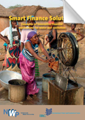
Smart Finance Solutions
NWP, NWP (2009)
This booklet on Smart Finance Solutions, like its equivalents on water and sanitation, gives examples of how different financial mechanisms are being used to finance water, sanitation projects and small local businesses that contribute to reaching MDG-7.
The first chapter of this booklet describes different financing mechanisms being applied at household / community (micro-) and at intermediate institutional (meso-) level. It gives examples of how these mechanisms are being used to finance water and sanitation projects or small/ medium enterprises. It also provides the reader with some useful links for further reading.
The second part of the booklet describes which business models can be used to obtain different financial mechanisms and gives an overview of how to write a successful business plan or project proposal. This booklet also includes a list of organisations that finance water and sanitation projects/ businesses.
The booklet is designed as a source of inspiration, rather than a manual. It will however provide links to further, more in-depth information. (source)
Serie:
Smart water solutions (all items in this serie)
Categories:
Socio-economic and organisation
Micro-finance
Smart water solutions (all items in this serie)
Categories:
Socio-economic and organisation
Micro-finance
Smart Sanitation Solutions
NWP, NWP (2006)
This booklet on sanitation, like its counterpart Smart Water Solutions, gives examples of household and community-based sanitation solutions that have proven effective and affordable. It illustrates a range of innovative sanitation technologies that have already helped thousands of poor families to improve their lives. The technologies described are a source of inspiration. (source)
Smart Water Harvesting Solutions
NWP, NWP (2007)
This booklet on Smart Water Harvesting describes a number of creative solutions in situations where ‘there seems to be no water’. It shows practical efforts to ‘create water’, especially in drought prone areas. It does not limit itself to the act of harvesting, but includes ‘capturing’ water during periods of rain, so that it is available for periods of drought. Many of the technologies highlighted in this booklet are traditional, but neglected in the modern world, as people try to become less dependent on the wiles of nature. There is an increasing awareness that rather than fighting against nature, people should co-operate with it. That is what water harvesting tries to do.
Like its equivalents on Smart Water and Smart Sanitation, this book gives examples that have proven to be effective and affordable. The book is an effective source of inspiration for local communities, civil engineers, NGOs, research institutes, donors and governments. (source)
Serie:
Smart water solutions (all items in this serie)
Categories:
Technology and techniques
Rainwater harvesting
Roofwater harvesting
Infiltration and artificial recharge
Smart water solutions (all items in this serie)
Categories:
Technology and techniques
Rainwater harvesting
Roofwater harvesting
Infiltration and artificial recharge
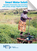
Smart Water Solutions (English)
NWP, NWP (2006)
This booklet on water gives examples of innovations such as the use of sunlight to purify water, effective low-cost water filters, low-cost drip irrigation and locally prodcued hand pumps that are five times cheaper than imported pumps. By usiing these technologies, poor rural families can double or even triple their annual income.
The book is designed as a source of inspiration, rather than a 'how to' manual.
This publication is a collaborative effort by eight organisations: NWP (Netherlans Water Partnership), Practica, Simavi, IRC, Agromisa, NCDO, Aqua for All, Partners for Water. (source)
Serie:
Smart water solutions (all items in this serie)
Categories:
Irrigation, agriculture and land husbandry
Technology and techniques
Water quality, treatment and purification
Smart water solutions (all items in this serie)
Categories:
Irrigation, agriculture and land husbandry
Technology and techniques
Water quality, treatment and purification
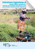
Soluciones Ingeniosas de Agua
NWP, NWP (2006)
Este folleto sobre agua, al igual que su homólogo Smart Sanitation Solutions (Soluciones Inteligentes en Instalaciones Sanitarias), ofrece ejemplos de soluciones innovadoras como el uso de la luz solar para purificar agua, filtros de agua baratos, sistemas de riego por goteo de bajo costo y bombas de mano de producción local que son cinco veces más baratas que las bombas importadas. (source)
Serie:
Smart water solutions (all items in this serie)
Categories:
Irrigation, agriculture and land husbandry
Technology and techniques
Water quality, treatment and purification
Smart water solutions (all items in this serie)
Categories:
Irrigation, agriculture and land husbandry
Technology and techniques
Water quality, treatment and purification
Soluções Hídricas Inteligentes
NWP, NWP (2006)
Este livrete sobre água, assim como a sua contrapartida Soluções Inteligentes de Sanidade Pública (Smart Sanitation Solutions), oferece exemplos de inovações como a utilização da luz solar para a purificação de água,filtros de água eficazes de custo reduzido,irrigação gota a gota a custo reduzido e bombas manuais produzidas localmente que são cinco vezes mais baratas do que bombas importadas.Mediante a utilização destas tecnologias, as famílias rurais pobres podem duplicar ou até mesmo triplicar os seus rendimentos anuais.
Soluções de pequena escala demonstraram ser mais rentáveis.Ao serem implementadas em grande número, podem ao mesmo tempo impulsionar a saúde, melhorar a produção agrícola e gerar actividades económicas.É por isso que éfundamental a disseminação em grande escala destas tecnologias.Tecnologias inteligentes como estas nos ajudam a enfrentar imediatamente a pobreza. (source)
Serie:
Smart water solutions (all items in this serie)
Categories:
Technology and techniques
Water quality, treatment and purification
Smart water solutions (all items in this serie)
Categories:
Technology and techniques
Water quality, treatment and purification
Strategies for Managed Aquifer Recharge (MAR) in semi-arid areas
Ian Gale, UNESCO International Hydrological Programme, IAH (2005)
The document provides insight into implementing and managing aquifer recharge (MAR) as part of wider water management strategies and, together with other UNESCO-IAH activities. (source)
SubSurface Dams: a simple, safe and affordable technology for pastoralists
VSF-Belgium, VSF-Belgium (2006)
A manual on SubSurface Dams construction
based on an experience of Vétérinaires Sans Frontières
in Turkana District (Kenya) (source)
Technology notes
WaterAid, WaterAid (2007)
These technology notes have been prepared following many general enquiries for technical information having been received by WaterAid over the years.
Their purpose is to give an outline of the technologies used by WaterAid on long-term development projects in Africa and Asia, and to show alternatives which might be appropriate in different circumstances.
It may be possible to determine from the notes the technology which would be appropriate in a particular location.
If it is proposed to proceed with the design and construction of a project using any of the principles set out in these notes, it is strongly recommended that further details be obtained from a specialist or from the reference books which are listed at the end of the relevant section. (source)
The auger hole method; A field measurement of the hydraulic conductivity of soil below the water table
W.F.J. van Beers, ILRI (1983)
A detailed description to determine the hydraulic conductivity using the Auger Hole method (source)
The influence of sand dams on rainfall-runoff response and water availability
Jasper Jansen, VU (2007)
(source)
Serie:
Sanddam.org Sand storage dams reports (all items in this serie)
Categories:
Rainwater harvesting
Infiltration and artificial recharge
Surface water hydrology
Groundwater hydrology
Sanddam.org Sand storage dams reports (all items in this serie)
Categories:
Rainwater harvesting
Infiltration and artificial recharge
Surface water hydrology
Groundwater hydrology
The Water Channel
TheWaterChannel is an online video channel completely dedicated to water related videos.
Traditions and innovations in land husbandry; Building on local knowledge in Kabale, Uganda
Will Critchley, Dan Miiro, Jim Ellis-Jones, Stephen Briggs, Joy Tumuhairwe, Sida's Regional Land Management Unit (1999)
A book which describes an approach for improving the conservation of land for production. The book relates the experience of a project in South-West Uganda to build on local practices of soil and water conservation. (source)
Serie:
RELMA Technical Handbook Series No. 20 (all items in this serie)
Categories:
Irrigation, agriculture and land husbandry
Socio-economic and organisation
RELMA Technical Handbook Series No. 20 (all items in this serie)
Categories:
Irrigation, agriculture and land husbandry
Socio-economic and organisation
Tutorial: Using free online data to determine catchment boundaries
This tutorial explains the possibilities of freely available worldwide elevation maps. Data from these maps can be used in hydrological projects, for example to determine catchment boundaries.
ULAMP extension approach, A guide for field extension agents
Anthony Nyakuni, Sida's Regional Land Management Unit (2001)
This is an extension manual for the Ugandan Land Management Programme and the Swedish Regional Land Management Unit (RELMA). It gives simple guidelines for extension personnel in how to implement participatory, bottom-up approaches in agricultural extension and rural development. (source)
Serie:
RELMA Technical Handbook Series No. 25 (all items in this serie)
Categories:
Socio-economic and organisation
RELMA Technical Handbook Series No. 25 (all items in this serie)
Categories:
Socio-economic and organisation
UN FAO Africover
A web-interface to quickly view and query the different GIS maps of the UN FAO Africover database. To actually download the data you have to go to this website: http://www.africover.org/system/africover_data.php and register.
Understanding hydrological processes in an ungauged catchment in sub-Saharan Africa
Marloes L. Mul, CRC Press/Balkema (2009)
A thesis towards the better understanding of the hydrological processes in ungauged catchments in sub-Saharan Africa (source)
USGS geology, oil and gas map of Africa
Maps showing geology, oil and gas fields and geologic provinces of Africa.
Water for Rural Communities
Erik Nissen-Petersen, Birgit Madsen, Munguti Katui-Katua, DANIDA (2006)
How Kenyan rural communities can create their own water supplies with assistance from the Water Services Trust Fund (source)
Serie:
Water for Arid Lands Book 2 (all items in this serie)
Categories:
Technology and techniques
Socio-economic and organisation
Micro-finance
Water for Arid Lands Book 2 (all items in this serie)
Categories:
Technology and techniques
Socio-economic and organisation
Micro-finance
Water from Dry Riverbeds
Erik Nissen-Petersen, DANIDA (2006)
How dry and sandy riverbeds can be turned into water sources by hand-dug wells, subsurface dams, weirs and sand dams (source)
Serie:
Water for Arid Lands Book 3 (all items in this serie)
Categories:
Technology and techniques
Rainwater harvesting
Infiltration and artificial recharge
Water for Arid Lands Book 3 (all items in this serie)
Categories:
Technology and techniques
Rainwater harvesting
Infiltration and artificial recharge
Water from roads
Erik Nissen-Petersen, DANIDA (2006)
A handbook for technicians and farmers on harvesting rainwater from roads (source)
Serie:
Water for Arid Lands Book 6 (all items in this serie)
Categories:
Technology and techniques
Rainwater harvesting
Infiltration and artificial recharge
Water for Arid Lands Book 6 (all items in this serie)
Categories:
Technology and techniques
Rainwater harvesting
Infiltration and artificial recharge
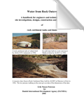
Water from Rock Outcrops
Erik Nissen-Petersen, DANIDA (2006)
A handbook for engineers and technicians on site investigations, designs, construction and maintenance of rock catchment tanks and dams (source)
Serie:
Water for Arid Lands Book 1 (all items in this serie)
Categories:
Technology and techniques
Rainwater harvesting
Infiltration and artificial recharge
Water for Arid Lands Book 1 (all items in this serie)
Categories:
Technology and techniques
Rainwater harvesting
Infiltration and artificial recharge
Water from roofs
Erik Nissen-Petersen, DANIDA (2006)
A handbook for technicians and builders on survey, design, construction and maintenance of roof catchments (source)
Serie:
Water for Arid Lands Book 7 (all items in this serie)
Categories:
Technology and techniques
Rainwater harvesting
Roofwater harvesting
Water for Arid Lands Book 7 (all items in this serie)
Categories:
Technology and techniques
Rainwater harvesting
Roofwater harvesting
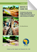
Water from sand rivers; A manual on site survey, design, construction and maintenance of seven types of water structures in riverbeds
Erik Nissen-Petersen, Sida's Regional Land Management Unit (2000)
Sand rivers, also called dry riverbeds, transport rainwater run-off from highlands to the sea through the most dry parts of this planet where water is very scarce. Although flood water may be drawn from the sand in some riverbeds for a short period of time after floods, the big majority of sand rivers are dry throughout the years. This book explains in simple terms how dry riverbeds can be changed into water sources for long periods after floods - and in some cases throughout the years. The usual problems of contamination and evaporation in hot climates are almost eliminated due the water being trapped and stored underground between the sand particles of riverbeds. This book is based on the author’s practical experience on developing affordable water supply systems in some of the driest parts of Africa and Asia over the last 25 years. (source)
Serie:
RELMA Technical Handbook Series No. 23 (all items in this serie)
Categories:
Rainwater harvesting
Infiltration and artificial recharge
RELMA Technical Handbook Series No. 23 (all items in this serie)
Categories:
Rainwater harvesting
Infiltration and artificial recharge
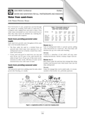
Water from sand-rivers
Erik Nissen-Petersen, WEDC Conference (1997)
A manual with guidelines for extraction of water out of (dry) sand rivers. (source)
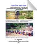
Water from Small Dams
Erik Nissen-Petersen, DANIDA (2006)
A handbook for technicians, farmers and others on site investigations, designs, cost estimates, construction and maintenance of small earth dams (source)
Serie:
Water for Arid Lands Book 4 (all items in this serie)
Categories:
Technology and techniques
Rainwater harvesting
Infiltration and artificial recharge
Water for Arid Lands Book 4 (all items in this serie)
Categories:
Technology and techniques
Rainwater harvesting
Infiltration and artificial recharge
Water harvesting; A Manual for the Design and Construction of Water Harvesting Schemes for Plant Production
Will Critchley, Klaus Siegert, FAO (1991)
A manual that focusses on simple, field scale systems for improved production of crops, trees and rangeland species in drought prone areas. (source)
Categories:
Water Measurement with Flumes and Weirs
A.J. Clemmens, T.L. Wahl, M.G. Bos, J.A. Replogle, ILRI (2001)
A manual that describes how to design, construct, and operate long-throated flumes to measure and control water flow in open channels. (source)
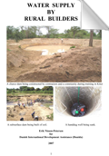
Water supply by Rural Builders
Erik Nissen-Petersen, DANIDA (2006)
This handbook, Water Supply by Rural Builders, is the 8th in a series of handbooks that gives guidelines on how to carry out simple, yet adequate, surveys, designs and construction of basic water projects. (source)
Serie:
Water for Arid Lands Book 8 (all items in this serie)
Categories:
Socio-economic and organisation
Water for Arid Lands Book 8 (all items in this serie)
Categories:
Socio-economic and organisation
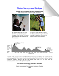
Water Surveys and Designs
Erik Nissen-Petersen, DANIDA (2006)
Explains survey techniques and gives standard designs with average costs on water supply structures (source)
Serie:
Water for Arid Lands Book 5 (all items in this serie)
Categories:
Technology and techniques
Socio-economic and organisation
Water for Arid Lands Book 5 (all items in this serie)
Categories:
Technology and techniques
Socio-economic and organisation
WHO Chemical fact sheets
WHO, WHO ()
A list with the chemical properties and effects of substances in relation to water quality and hygiene (source)
WHYMAP - groundwater resources maps per continent
Groundwater resources maps for each continent. These maps are also available for in the WHYMAP webviewer: http://www.bgr.de/app/fishy/whymap/.
WHYMAP - Web viewer
Online viewer of the groundwater resources maps. PDF versions of the maps can be downloaded here: http://www.whymap.org/nn_354300/whymap/EN/Downloads/Continental__maps/contimaps__node__en.html?__nnn=true.
WHYMAP - World-wide groundwater resources maps
Global maps of 'Groundwater Resources of the World' and Large aquifer systems of the world (scale 1:25,000,000 to 1:50,000,000).
World Map Finder
WorldMapFinder has a huge collection of maps collected from the internet. All maps are sorted by countries, cities and so on.
ZamZar file conversion
Free online conversion from (almost) any format to (almost) any format (images, documents, music, videos, archives, etc.).
