



Filter op categorie
Toelichting
SamSamWater maakt informatie over water en sanitatie beschikbaar en toegankelijk voor iedereen.
Hierom hebben we een database opgezet, die via deze pagina geraadpleegd kan worden. De database bevat allerlei informatie, bijvoorbeeld 'best practices' (bewezen technieken), kaarten, geo-informatie en achtergrondinformatie. De informatie is afkomstig van verschillende bronnen, waaronder onderzoeksinstituten, bedrijven, organisaties en overheidsinstellingen.
Als u informatie heeft die wij in onze database kunnen opnemen, of als u opmerkingen of vragen heeft, dan horen wij dit graag!
N.B. De documenten en beschrijvingen op deze pagina zijn vooralsnog alleen beschikbaar in het Engels.
37 items gevonden in de categorieën:
Kaarten en GIS-gegevens
Verwijder zoekfilter.
Kaarten en GIS-gegevens
Verwijder zoekfilter.
AfricaMap
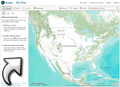
Brilliant collection of maps. Contains an extensive resource of topographical maps, from 1:1,000,000 reference maps to 1:2,500 city maps. To view the maps, click on the tab 'Map Layers', click on 'Base mapping' and select the desired maps.
ArcGIS Services Directory
Directory of the ESRI basemaps, with links to open them in ESRI software (e.g. ArcMAP) or in Google Earth (not available for every map).
ASTER GDEM
Web interface to select and download ASTER Global Digital Elevation Model (GDEM) files. The ASTER GDEM has a resolution of 15 x 15 meter and is the most detailed elevation model that is freely available worldwide.
Digital atlas of Namibia
Contains maps on climate, physical geography, living-resources, land & history and people, services & infrastructure.
DIVA GIS
Download free GIS data (boundaries, places, roads, elevation, land cover, population) for any country in the world.
East View Cartographic
Online shop selling a wide range of maps including topographic maps of many (developing) countries. Some maps are available in print, others only as digital files. Has a wider collection than Omnimap, but is more expensive.
European Digital Archive of Soil Maps of Africa
An impressive collection of soil maps from all over Africa (over 2000!). All maps can be viewed and downloaded in high resolution. Contains also some topographical maps. Searchable by country, scale, year, of keyword.
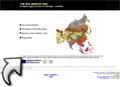
European Digital Archive of Soil Maps of Asia
A large collection of soil maps of Asia. Searchable by country, scale, year, of keyword.
European Digital Archive of Soil Maps of the World
Soil maps of the world, a large collection of scanned soil maps from all over the world.
Free Geography Tools - E00 conversion
Converting E00 Vector Data To Shapefiles. The method uses the program 'import71.exe'. If you have ArcView 9 this program can be found in the ArcGIS/bin/ folder where the ArcGIS program is installed.
GeoCommunity GIS Data Depot
Free GIS data on most countries of the world (boundaries, roads, places, rivers, etc.).
Geonames.org
Search for names of cities, town, villages, regions, districts, mountains, nature reserves, etc. in a worldwide geographical database. Contains (much) more names than Google Maps.
Global Land Cover Facility
An interface to search and download (free) satellite imagery from around the world. Imagery from (a.o.) Landsat, ASTER, IKONOS, MODIS and SRTM satellites can be accessed. Detailes on the different types of data can be found here: http://glcf.umiacs.umd.edu/data/.
Google Map Maker Data Download
Download the GIS data (in .SHP or .KML format) that is behind Google Maps. Contains information on (rail)roads, places, waterbodies, nature reserves, etc. The data is provided free for non-commercial use.
IGRAC Global Groundwater Information System
Global Groundwater Information System, with maps on groundwater quality, quantity, development, artificial recharge and more. But it only shows averages per country. Only works in Internet Explorer.
ILRI GIS data
Search and download (free) GIS data from the ILRI (International Livestock Research Institute). Contains much GIS data on Kenya (from boundaries to population data) and some data on other countries.
ISRIC - World Soil Information Database
ISRIC - World Soil Information Database, you can search the database using the menu on the left. Some of the reports and maps can be viewed online and downloaded.
Map Library
The Map Library is a source of public domain basic map data concerning administrative boundaries in developing countries. Contains data from Africa and Central America.
NASA SRTM elevation data
Information and backgrounds on the SRTM (Shuttle Radar Topography Mission) elevation data (DEM). The data can also be downloaded from this site, however the interface at GLCF is much more easy to navigate.
OneGeology Portal
A beautiful web-viewer with a lot of digital geological maps all over the World. Some maps have a very large scale (continent), others are more detailed (country). You can export the maps from their portal as KML files to view in Google Earth. Background information and a 'Getting started' guide can be found here: http://www.onegeology.org/portal/home.html.
Onimap
Online shop selling a wide range of maps including topographic maps of many (developing) countries. Some maps are available in print, others only as digital files. Has a (bit) smaller collection than Eastview, but is (much) cheaper.
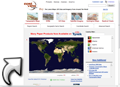
Poehali Russion Topo Maps
Very detailed topographic maps made in Soviet time, but are still very useful for reference, although the Russian labels are hard to read. In the bottom left of the screen you can switch the interface to English.
SamSamWater UTM Zones Tool
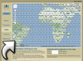
The Universal Transverse Mercator (UTM) coordinate system is a method of specifying locations on Earth. When working with a GPS or maps based on the UTM-system, it is necessary to know in which UTM zone you are. This tool displays all UTM grid zones on a map, which enables you to find the correct zone.
Search Alterra maps
A collection of maps from the Alterra Institute (Wageningen University). Use the searchform on the right, the 'Region thesaurus' on the left doesn't work properly.
Tutorial: Using free online data to determine catchment boundaries
This tutorial explains the possibilities of freely available worldwide elevation maps. Data from these maps can be used in hydrological projects, for example to determine catchment boundaries.
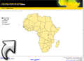
UN FAO Africover
A web-interface to quickly view and query the different GIS maps of the UN FAO Africover database. To actually download the data you have to go to this website: http://www.africover.org/system/africover_data.php and register.
USGS geology, oil and gas map of Africa
Maps showing geology, oil and gas fields and geologic provinces of Africa.
WHYMAP - groundwater resources maps per continent
Groundwater resources maps for each continent. These maps are also available for in the WHYMAP webviewer: http://www.bgr.de/app/fishy/whymap/.
WHYMAP - Web viewer
Online viewer of the groundwater resources maps. PDF versions of the maps can be downloaded here: http://www.whymap.org/nn_354300/whymap/EN/Downloads/Continental__maps/contimaps__node__en.html?__nnn=true.
WHYMAP - World-wide groundwater resources maps
Global maps of 'Groundwater Resources of the World' and Large aquifer systems of the world (scale 1:25,000,000 to 1:50,000,000).
World Map Finder
WorldMapFinder has a huge collection of maps collected from the internet. All maps are sorted by countries, cities and so on.
